
 The Accurate Reloading Forums
  THE ACCURATE RELOADING.COM FORUMS
  Hunting
  African Big Game Hunting
  Lowveld Rhino Trust
Go  | New  | Find  | Notify  | Tools  | Reply  |  |
| One of Us |
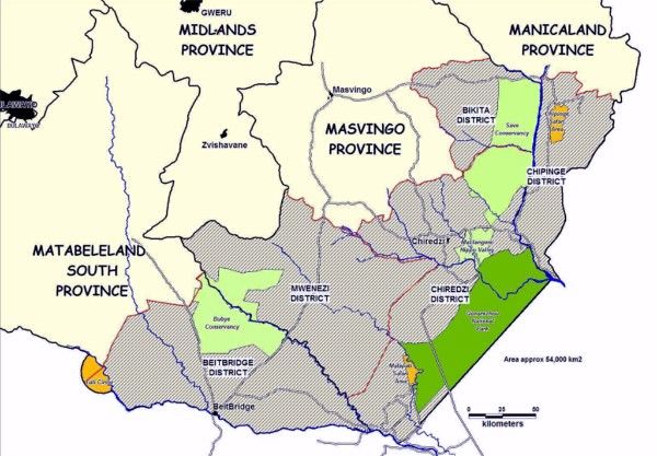
I got this map from the LRT website. Can anyone tell me what the large shaded area surrounding the conservancies represents? Are they tribal lands? CAMPFIRE lands? Does the LRT have any legal authority over them? Why are they included in this map? Thanks  | ||
|
| One of Us |
While we have the map up does anyone know where Nuanetsi (Hunting area) falls into this picture. I could be wrong but is it due east of the BVC? | |||
|
| One of Us |
Southern African Lowveld defined by Stevenson Hamilton as less than 650m | |||
|
| Powered by Social Strata |
| Please Wait. Your request is being processed... |
|

Visit our on-line store for AR Memorabilia

